The Mayan Ruins at Altun Ha, Belize
|
|||||
|
The Mayan Ruins at Altun Ha, Belize |
|||||
 |
|
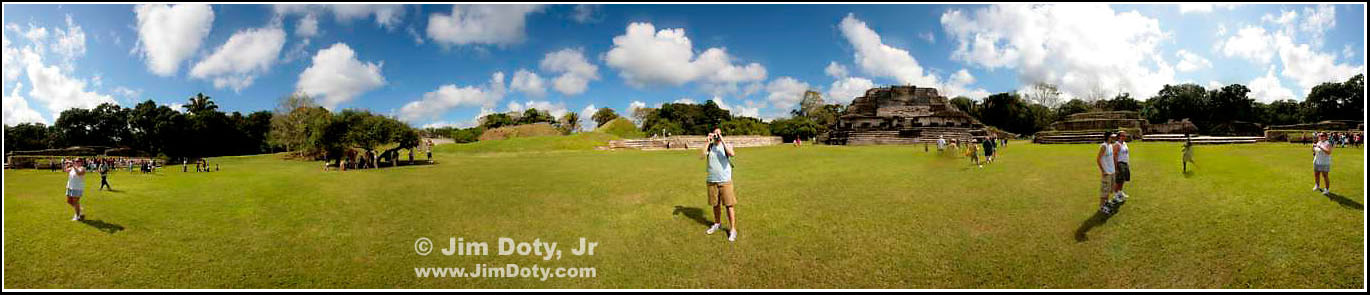
The Mayan Ruins at Altun Ha (literally: "Rockstone Pond") are a good hour or more bus ride from Belize City, Belize. The main ruins are centered around two plazas. The panoramic photo above was taken in the middle of Plaza B (south plaza). Some of the ruins can be climbed. It is preferable to take a guided archaeological tour to have a better idea of the significance of what you are seeing. The panoramic photo above encompasses more than 360 degrees. My son Jared is in the middle taking a photo.The tourist on the far left and right is the same person. Several photos were stitched together automatically with Autostitch software to create this photo. Any place people moved between overlapping photos, there is a slight blurring of the image. |
 |
|
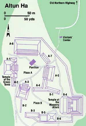
The View from the Top The view looking west from the top of the "Temple of the Masonry Altars" (see the map below). Plaza B is to the left and is bordered on the north by the long, low building with the long row of steps. In this photo, Plaza A (north plaza) is above and to the right of Plaza B. The pyramid/temple on the north side of Plaza A has not been uncovered and looks like a hill with smooth sides. Other pyramids around Plaza A are partially uncovered. These two ceremonial plazas make up only a small part of the total city which had a total area of 25 square miles. Most of the ruins are hidden in the jungle. At its peak, Altun Ha had a population estimated as high as 10,000. |
 |
|
Temple of the Masonry Altars, |
 |
|
May 10, 2007 |
|
Copyright © Jim Doty, Jr. All rights reserved. |
|
|
|
||||||||||||||||||||||||